Monitoring and Tracking
Keeping a Finger on the Pulse of Bird Populations.
Monitoring is an essential component of wildlife management and conservation science. Effective monitoring programs can identify species that are at-risk due to small or declining populations, provide an understanding of how management actions affect populations, evaluate population responses to landscape alteration and provide basic information on species distributions. Technological advances in revolutionized our ability to track birds as they move across the landscape filling vital knowledge gaps on when, where and how migratory birds species move across the landscape. Given the alarming, large-scale declines of bird populations and the loss, fragmentation and degradation of native habitats, the need for rigorous bird monitoring and tracking programs is greater than ever.
At Bird Conservancy of the Rockies, our bird monitoring and tracking programs are essential for understanding population status and trends, the response to management and the migratory movements of birds. Our monitoring programs are designed to obtain count-based data for diurnal breeding bird species using a randomized, spatially balanced sampling design at the local and regional scale. Our tracking programs are supporting the development of a continent scale network of stations and bird tagging effort to tracking migratory bird movement. We also develop custom programs for specific focal species of conservation concern.
Click below to learn more about Bird Conservancy’s monitoring programs.
Integrated Monitoring in Bird Conservation Regions (IMBCR) Program
Every year, biologists and technicians traipse across mountains, prairies, and deserts to survey breeding birds under the Integrated Monitoring in Bird Conservation Regions (IMBCR) program. The program, coordinated by Bird Conservancy of the Rockies, is the second largest breeding bird monitoring program in North America, stretching across private and public land from the Great Plains to the Great Basin. View this IMBCR StoryMap for a dynamic look at the program.

IMBCR stands for Integrated Monitoring in Bird Conservation Regions. The program was created to address large-scale declines of avian populations and the need for extensive and rigorous landbird monitoring. Click for an overview on our IMBCR program.
Coverage of the Integrated Monitoring in Bird Conservation Regions (IMBCR) program across multiple Bird Conservation Regions.
The IMBCR program includes a statistically rigorous design based on probabilistic sampling, and a broad network of partners that support the program through funding or data collection. What we learn through annual monitoring and targeted monitoring projects (ie, overlays) informs management decisions and contributes to bird and habitat conservation. Population estimates for over 300 species are now available on the Rocky Mountain Avian Data Center 2.0!
Monitoring Objectives
Vision Statement: Provide science-based information on bird populations to guide conservation and management decisions.
Mission Statement: Through a collaborative network of scientists, land and wildlife management agencies, conservation organizations, tribes, and private landowners and communities, provide accessible, scientifically defensible estimates of bird density, abundance, occupancy, and trend to inform science-based decisions that help maintain, enhance, and recover bird populations from impacts of natural and anthropogenic factors, and evaluate how landuse decisions affect bird populations, and thus, biodiversity and ecosystem services.
Click here to download the complete IMBCR vision and mission statement.
Specific objectives of the IMBCR program include:
- Provide a framework to integrate bird monitoring efforts across Bird Conservation Regions;
- Provide robust population density and occupancy estimates that account for incomplete detection and are comparable at different geographic extents;
- Use annual population estimates to monitor population trends and evaluate causes of population change;
- Provide basic habitat association data for most landbird species to address habitat management issues;
- Maintain a high-quality database that is accessible to all of our collaborators, as well as to the public over the Internet, in the form of raw and summarized data; and
- Generate decision support tools that help guide conservation efforts and provide a quantitative measure of conservation success.
History
In 2007, the North American Bird Conservation Initiative developed the report Opportunities for Improving Avian Monitoring. This report outlined goals and recommendations to further improve avian monitoring programs including: using more rigorous statistical methodology, integrating monitoring programs, and making data and results widely accessible to land managers and the public. With these recommendations in mind, bird conservation partners from across much of the western United States have collaborated to design and implement a broad-scale, all-lands monitoring program known as Integrated Monitoring in Bird Conservation Regions (IMBCR).
The IMBCR program was pilot tested in Colorado in 2008, and has since expanded throughout the Great Plains and western US.
Design
Using the intersection of Bird Conservation Regions and state boundaries as the primary level of stratification, strata are defined by IMBCR partners based on areas to which inferences are needed, such as an individual national forest. We select spatially balanced samples within each stratum, allowing changes in sampling effort for fluctuating budgets or addressing management questions.
This sampling design allows comparison of bird populations across spatial and temporal scales. Technicians survey birds for 6 minutes at up to 16 points within a transect. Observers record distances to each bird and the minute interval for each detection. We use these data to estimate detection probabilities for density, occupancy, and population trend estimates.
Where We Monitor
State Programs
In 1995, the Bird Conservancy and partners began efforts to create and conduct a Colorado-wide program to monitor breeding bird populations. This was the first attempt in the nation to develop and implement a statewide all-bird monitoring plan. Today, statewide bird monitoring takes place in several states, including Colorado, Wyoming, Montana and Utah as part of the larger IMBCR program.
National Parks Programs
More than 270 parks managed by the National Park Service are organized into a system of 32 eco-regional networks linked by similar geographic and natural resource characteristics. The Bird Conservancy works with the National Park Service to monitor birds on several of these networks. In 2013, the Bird Conservancy began monitoring birds in the Northern Great Plains Network under the IMBCR program.
National Forest Programs
National forests and grasslands provide important habitat for diverse bird species. In 2001, the Bird Conservancy and the U.S. Forest Service began a partnership to monitor bird populations on Forest Service lands, including National Grasslands. Before then, no long-term bird monitoring programs existed for National Grasslands. Today, the Bird Conservancy monitors bird populations on forests and grasslands across several Forest Service regions, including all of Region 1, Region 2, Region 3 and Region 4, as part of the larger IMBCR program.
BLM Projects
Bureau of Land Management lands in the western United States provide key habitat for a variety of sagebrush and grassland species The Bird Conservancy partners with the BLM to survey birds in Colorado, Utah, Nevada, Oregon, Montana, North and South Dakota, Idaho, California, Wyoming, Arizona and New Mexico as part of the larger IMBCR program.
Protocols
Access past and current field protocols under the IMBCR Resources & Applications below.
Partners
Arizona Game and Fish Department, Audubon Dakota, Audubon New Mexico, Audubon Rockies, Colorado Parks and Wildlife, Colorado State Land Board, Great Basin Bird Observatory, Great Northern Landscape Conservation Cooperative, Great Plains Landscape Conservation Cooperative, Intermountain Bird Observatory, Kansas Department of Wildlife and Parks, Klamath Bird Observatory, Knobloch Family Foundation, Montana Fish, Wildlife and Parks, National Fish and Wildlife Foundation, Natural Resource Conservation Service, Nebraska Game and Parks Commission, New Mexico Game and Fish, North Dakota Game and Fish Department, Northern Great Plains Joint Venture, Oklahoma Department of Wildlife Conservation, Playa Lakes Joint Venture, Ricketts Conservation Foundation, South Dakota Game, Fish and Parks, Texas Parks and Wildlife, Tracy Aviary, The Dolores River Restoration Partnership, US Bureau of Land Management, US Department of Defense, US Farm Service Agency, US Fish and Wildlife Service, US Forest Service, US National Park Service, University of Montana, Utah Division of Wildlife Resources, World Wildlife Fund, Wyoming Game and Fish Department, Wyoming Natural Diversity Database
IMBCR Resources & Applications
See below for IMBCR-related applications and resources, such as publications and factsheets. Contact Jen Timmer if you have an IMBCR data application you would like to share or complete this form if you would like to request the raw data. For IMBCR-related information and resources in the Playa Lakes Joint Venture region (e.g., annual reports), visit IMBCR for PLJV. For general information on the IMBCR program, visit this page. For a dynamic look at the program, view the IMBCR StoryMap.
The Rocky Mountain Avian Data Center 2.0 is now available to access population estimates, species counts, and sampling effort for the various IMBCR strata or areas of inference.
One-Pagers
Why monitor birds with the IMBCR Program?
IMBCR Frequently Asked Questions
Comparison of Breeding Bird Survey and IMBCR
Description of IMBCR Population Metrics
Checking the Pulse on Bird Populations with IMBCR Trends
Using IMBCR Trends to Inform State Wildlife Action Plan Revision
Estimating Population-Level Impacts for Project Planning
Sampling Design Guidelines & Recommended Sample Sizes
IMBCR for Playa Lakes Joint Venture
Monitoring breeding birds across USFS regions: an integrated approach
Integrated bird monitoring for management of rangelands (BLM land)
IMBCR costs and funding models
2020 IMBCR cost increase and justification
Effectiveness monitoring of CRP for grassland birds in the Southern Great Plains
Grassland bird response to the Lesser Prairie-Chicken Initiative
The impact of natural gas development on sagebrush birds in south-central Wyoming
Grazing impacts on migratory bird communities in montane shrublands
Reports
Click here to access other IMBCR related publications
Field Protocols
Click here to download the 2024 field protocol manual.
E-Newsletters
Overlay Projects and Data Applications
Google sheet containing information about overlay projects and data applications organized by habitat and organization with links to respective reports and other deliverables.
Data Requests
Google sheet of all IMBCR data requests from 2010-present
Past IMBCR Partners Meetings
2025 Partners Meeting: agenda, pictures, and presentations
2024 Partners Meeting: agenda, pictures, and presentations
2023 Partners Meeting: agenda, pictures, and presentations
2022 Partners Meeting: agenda, summary, and presentations
2021 Partners Meeting: agenda, summary, and presentations
2020 Partners Meeting: agenda, summary, and presentations
2019 Partners Meeting: agenda, summary, and presentations
Blogs
2024:
Combining standardized count data with community science to monitor bird populations by Qing Zhao
2023:
Reflections from the 2023 IMBCR Field Season by Matthew McLaren
A Day in the Life of a Field Technician by Julia Snieder
2022:
Rare Bird Alert! A Story of the Yellow Rail Detection in Colorado by Eric DeFonso
Birds by the Numbers by Jessie Reese, BCR
Monitoring birds and coordinating people by Jen Timmer, BCR
2021:
A morning on the IMBCR project by Jeremy Halka, Intermountain Bird Observatory
2020:
Fire, Forests, and Birds by Quresh Latif, Bird Conservancy of the Rockies
Integrated Monitoring for Rangeland Birds by Jen Timmer, Bird Conservancy of the Rockies
Beetles and Birds by Quresh Latif, Bird Conservancy of the Rockies
Follow the Data to Follow the Birds by Lily Abromeit, Playa Lakes Joint Venture
Integrated Monitoring in Bird Conservation Regions: Over Ten Years and Counting by Jen Timmer, Bird Conservancy of the Rockies
2019:
Six Seasons of Birds & Prairies by Michael McCloy, Texas A & M University
Private Land, Public Birds by Jen Timmer, Bird Conservancy of the Rockies
Conservation Ranching Initiative: Monitoring on Conservation Ranches by Evan Barrientos, Audubon Rockies
2018:
10 Years and Still Counting by Jen Timmer, Bird Conservancy of the Rockies
Off the Beaten Track by Bill DeMott, Bird Conservancy of the Rockies
A Tale of Two Methods by Rachel Sill, University of Wisconsin
2016:
IMBCR Ramping Up for Expanded Field Effort by Nick Van Lanen, Bird Conservancy of the Rockies
2015:
Collaborating Across the Atlantic to Conserve Birds by Max Mutter, Oxford University
IMBCR Survey Season Featured New Frontiers … and Lots of Rain! by David Kramer, Bird Conservancy of the Rockies
2014:
Sage Decisions: A New Tool for Sage-Steppe Management by Intermountain West Joint Venture
New Species Detected for IMBCR Program by Nick Van Lanen, Bird Conservancy of the Rockies
2013:
Rare Bird Spotted During IMBCR Training by Nick Van Lanen, Bird Conservancy of the Rockies
New Locales Lead to Cool New Species for IMBCR Program by Nick Van Lanen, Bird Conservancy of the Rockies
2011:
Scientists from Across the West Gather to Advance Bird Monitoring by Bird Conservancy of the Rockies
For more information:
Chris White
Director of Science Operations
(970) 482-1707 x 24
Migratory Ecology Program
Bird Conservancy of the Rockies studies grassland bird ecology during different parts of their full annual cycle to develop strategic conservation plans and recover populations. Migration is the biggest knowledge gap with respect to grassland bird ecology. Not much is known about specific routes used by grassland birds, or where they stop to rest and refuel. To fill these knowledge gaps, Bird Conservancy is developing and implementing a collaborative network of automated telemetry stations in the Great Plains-Chihuahuan Desert region, known as the Great Plains-Chihuahuan Desert (GPCD) Motus network. This network will function as part of the Motus Wildlife Tracking Network.
What is Motus?
The Motus Wildlife Tracking System is a global collaborative network of automated radio telemetry stations managed by Birds Canada. It is used in conjunction with small coded radio transmitters that are attached to small animals such as birds, bats, and some insects to study their movement.
Motus stations come in many different shapes and forms, but all contain the same three components: a sensor, an antenna, and a power source. All of our stations are outfitted with Cellular Tracking Technologies’ (CTT) SensorStation, which detects radio transmissions from Motus tags, and which is connected through either WiFi or cellular networks to automatically transfer data to Motus’ servers. The SensorStation is connected to six to eight directional (Yagi) antennas, which help the SensorStation detect the Motus tags, and the whole station is powered by either a solar panel or by plugging directly into an onsite power source.
Bird Conservancy Motus stations from Appleton Whittell Research Ranch in Elgin, AZ, the Alamosa National Wildlife Refuge in Alamosa, CO, and the Crane Trust in Wood River, NE.
Once a tagged animals passes within roughly 15 kilometers of a Motus station, it is detected and logged at that station and transmitted to Motus servers. This allows researchers to track birds across space and time without the need to re-capture individuals. The receiver stations are “open” to receiving data from animals tagged by any researcher across the network footprint so a single station can collect data from any number of species!
Tracking Grassland Birds
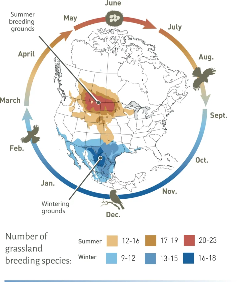
Grassland bird populations have declined by half over the past four decades (70-90% decline) due to grassland conversion, climate change, and tree and shrub encroachment, among other stressors. Many of these species use habitat within the GPCD grasslands at some point in their annual cycle. This region stretches from Canada through the Central United States into northern Mexico, and contains the majority of remaining grasslands in North America.
Focal Species within the Great Plains-Chihuahuan Desert (GPCD)
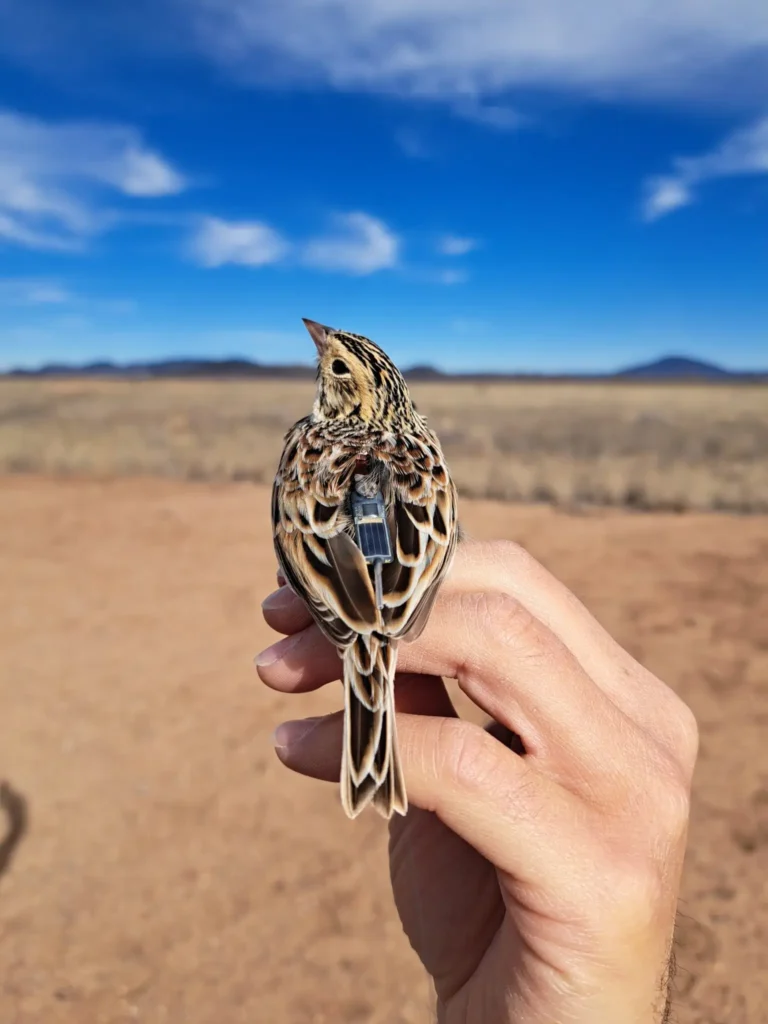
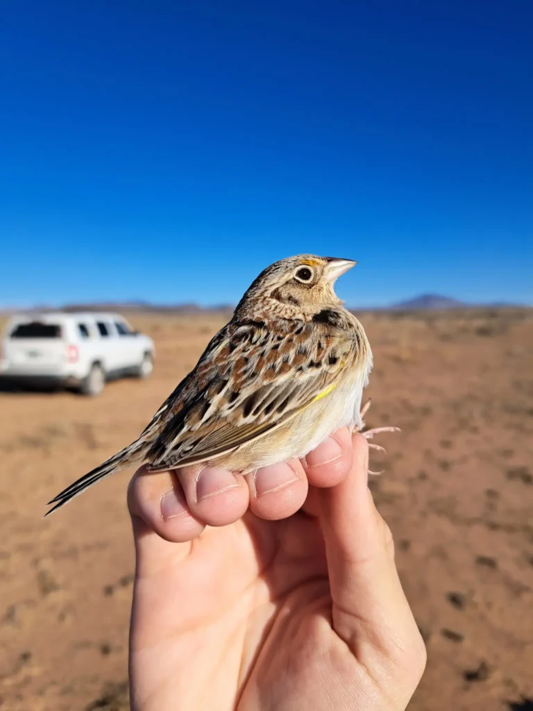
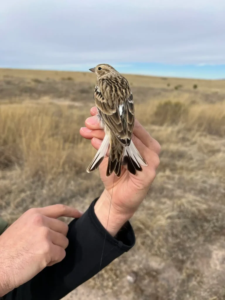
Grassland bird conservation efforts within the GPCD are essential because this region provides key habitat for the most steeply declining grassland species. This includes the Baird’s Sparrow, Thick-billed Longspur, Sprague’s Pipit, Chestnut-collard Longspur, and Grasshopper Sparrow. This suite of species are some of the GPCD network’s highest priority species for tagging and monitoring. The radio tags that are deployed on these grassland birds range from 0.25g-0.75g and can last anywhere from 90 days to the life of the bird depending on the model of tag used. Once a bird has been tagged and released, anytime it comes near a Motus station, its location is recorded and added to the Motus database. The data collected by the GPCD network on these focal species will help scientists better understand their long distance movement, stopover, and habitat use throughout their full annual cycles, which will help conservation practitioners and land managers to more effectively target conservation planning for the species most at risk of decline and extinction.
Migratory Ecology Program Contacts
Jessie Reese
Research Scientist and Migratory Ecology Program Coordinator
Matt Webb
Senior Avian Ecologist
Mountains to Plains Region Project
To aid conservation and management of grasslands in Colorado, Bird Conservancy of the Rockies has partnered with the City of Fort Collins to inventory and monitor grassland birds on city-owned properties in Larimer and Weld counties. The project began in 2006 and 2007 on Soapstone Prairie Natural Area, expanded significantly in 2008 and 2009 with the incorporation of Meadow Springs Ranch and Round Butte Ranch, and grew again in 2010 with the addition of the Bernard Ranch.
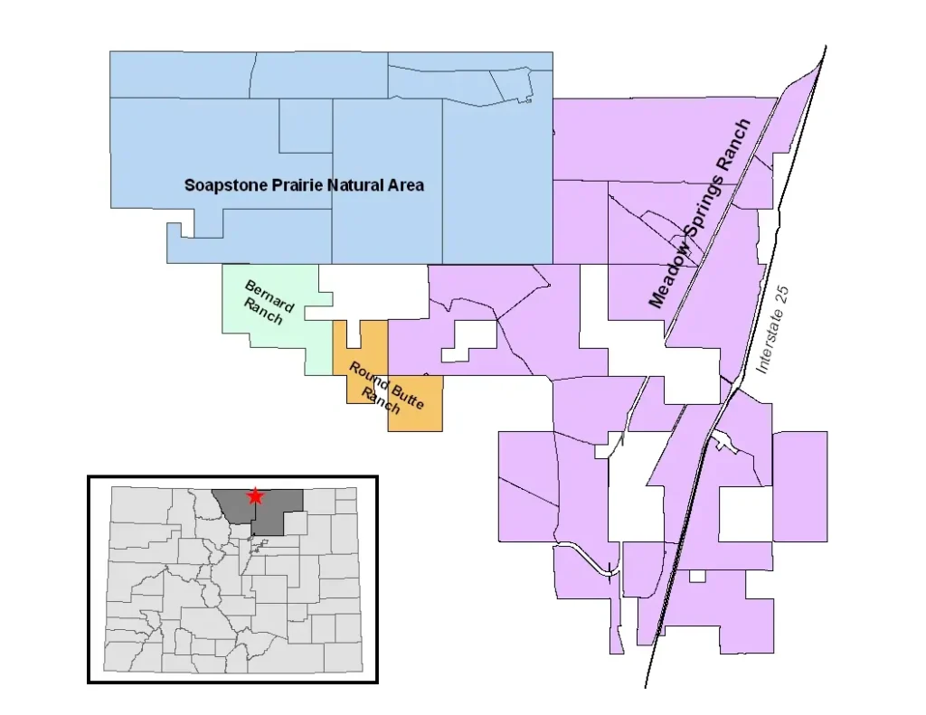
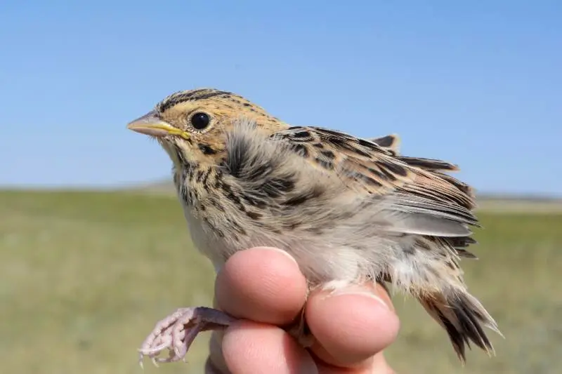
These properties support breeding populations of more than 20 high-priority bird species, primarily grassland species, recognized by Colorado Parks and Wildlife, U.S. Fish and Wildlife Service, Partners In Flight, the U.S. Shorebird Conservation Plan, The Nature Conservancy and other conservation groups. These properties comprise the southern end of the largest remaining contiguous prairie in North America, stretching from here to Alberta and Saskatchewan and east into Nebraska and the Dakotas, and thus present an incredible opportunity for grassland conservation.
National Ecological Observatory Network (NEON) Project
The National Ecological Observatory Network (NEON) is an independent organization created to manage large‐scale ecological observing systems and experiments on behalf of the scientific community. Its mission is to design, implement and operate continental scale research infrastructure, to open new horizons in ecological science and education and to enable ecological analyses and forecasts for the benefit of society. Bird Conservancy partners with NEON to conduct breeding bird surveys across many of its ecological sites in the United States. Through this project, Bird Conservancy is teaming up with partners across the U.S. to survey approximately 60 different sites from Alaska to Puerto Rico.
Non-breeding Monitoring for Avian Distribution and Status
Approximately 75% of North American birds are migratory and spend their winters in the southern U.S., Central America, and South America. To ensure we have accurate information for these migratory species throughout the year, Bird Conservancy’s monitoring work also extends into the non-breeding season with survey effort across the Chihuahuan Desert, from Texas to northern Mexico. Our non-breeding program is designed to assess status and trend for grassland birds of conservation concern on both private working lands and grassland priority conservation areas. These essential data can help us understand the habitat and management needs in order to develop conservation and recovery plans for the full annual cycle.
Focal Species
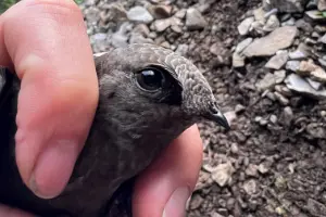
Birds are one of the most diverse sets of animals on the planet and as a result no single monitoring/ sampling approach is suitable for all species. To ensure we provide data for species not well sampled by programs like IMBCR, Bird Conservancy has developed a focal species program aimed towards species of conservation concern at the state or regional scale. Specifically, Bird Conservancy has conducted long-term monitoring on sensitive species like the Mexican Spotted Owl and Black Swift that are not well sampled using traditional sampling methodologies. Future focal species work may include efforts for early successional grassland birds like Burrowing Owl and Mountain plover as well as high elevation specialists like Rosy finches.
Are you a landowner who wants to get involved? Click here.
Get answers to frequently asked questions from landowners about surveying birds on private land.


