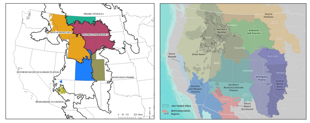
The Integrated Monitoring in Bird Conservation Regions (IMBCR) program started in Colorado in 2008 and has since expanded to 15 states and 10 Bird Conservation Regions. The program was the first in the nation to adopt a completely randomized, hierarchical approach to estimate bird abundance and occupancy across large regions in collaboration with numerous partners. It is now the second largest bird monitoring program in the United States! In honor of its 10th anniversary, it seems appropriate to celebrate a few examples how IMBCR data have benefited bird conservation over the past decade.
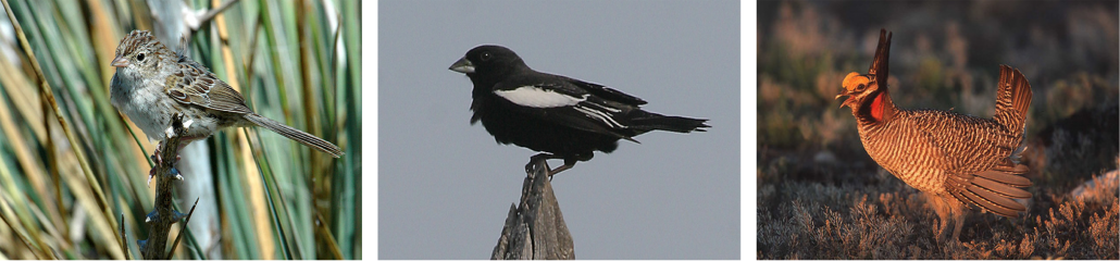
IMBCR data can be used to compare density and occupancy estimates across or within areas of interest. For instance, occupancy rates were compared in low and high-development areas in Wyoming’s Atlantic Rim Natural Gas Development Area to better understand the effects of natural gas development on sagebrush songbird populations. Investigators then compared the distance from survey locations to natural gas well pads and roadways to directly evaluate the impact of these features on avian populations. They found that roads can negatively impact Sagebrush Sparrows and Sage Thrashers, two species of conservation concern. You can read the full published article here.

Photo courtesy of USDA, Forest Service.
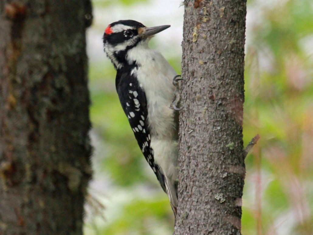
In another application, Bird Conservancy of the Rockies biologists tested hypotheses about the effects of forest structure on five spruce-fir bird guilds following spruce beetle outbreak in the Rio Grande National Forest, Colorado. Because of IMBCR’s multi-scale design, potential factors influencing songbird occupancy were included at the territory and landscape level. Biologists could then determine how short-term spruce beetle effects within territories scaled-up to affect populations at the landscape-scale over time.
Among the results, they found a positive response of woodpeckers and understory-dwelling species following spruce beetle outbreak. Management guidelines for spruce-fir songbirds were developed and combined with common spruce beetle management strategies to promote diversity of forest features, which support a diversity of songbird species. For example, removing dead trees or snags could benefit birds that glean insects from living tree bark, like Brown Creepers, but reduce habitat for species that nest in dead tree cavities, like Hairy Woodpeckers. Different recommendations affect a variety of species differently depending on life history traits, such as feeding and nesting behavior, so management guidelines should consider multiple species and guilds.
Data collected from IMBCR can be used in a variety of ways to evaluate conservation efforts. Another ongoing collaborative project aims to evaluate the effectiveness of Lesser Prairie-Chicken conservation practices for increasing grassland avian species richness. The Lesser Prairie-Chicken Initiative (LPCI) promotes several conservation practices to improve habitat for Lesser Prairie-Chickens, such as prescribed grazing. Although results are preliminary, songbird richness is higher on private lands employing LPCI practices.
and U.S. Department of Agriculture.
To inform management and conservation decisions, the IMBCR monitoring data can also be used to create decision support tools for managers. For example, a recent tool developed for sagebrush birds combines species distribution maps, local habitat relationships, and ecological sites within a structured framework. The tool evaluates the optimal management action (e.g., prescribed grazing or brush control) that could be employed to benefit sagebrush birds and forage production for livestock. The tool can also be used to select which area management should occur within to maximize benefits for the birds and producers alike.
Bird Conservancy biometrician, David Pavlacky and co-authors recently published a paper in an open-access scientific journal introducing the IMBCR program. This peer-reviewed article describes the development of the IMBCR sampling design and its ability to increase the value of large-scale monitoring data and meet multiple conservation and management objectives.
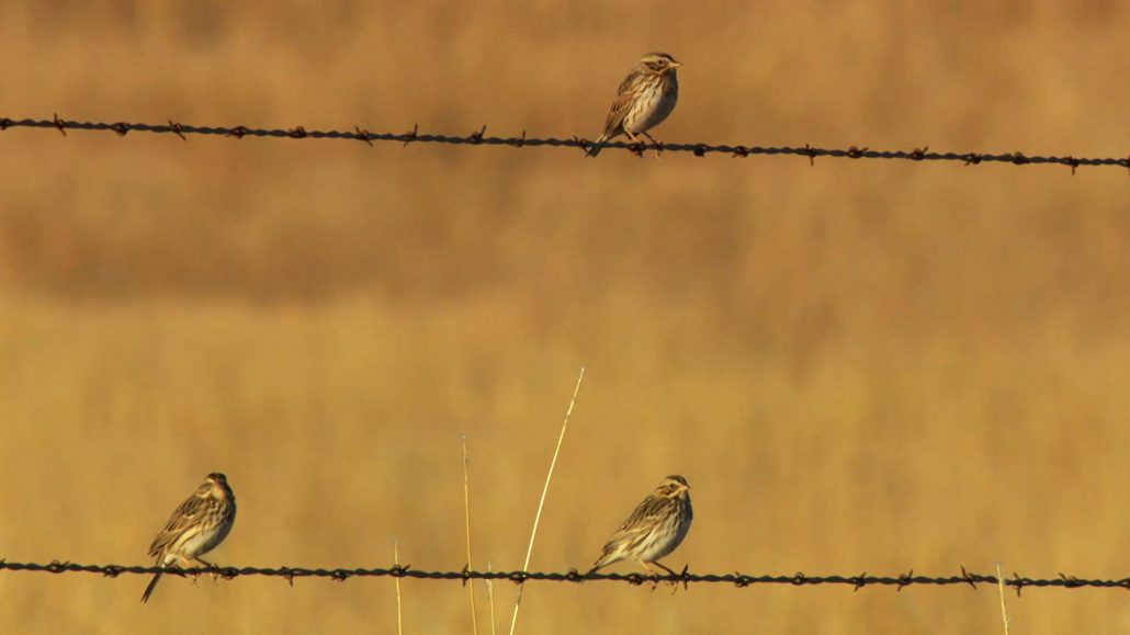
In an environment where funding and resources are limited, it’s vital to identify which species need the most immediate attention. Long-term monitoring programs like IMBCR help show trends over time, revealing areas of greatest need. Over 75% of prime bird habitat in the U.S. is privately owned, making it essential to count and conserve birds in those places, which include working lands. Bird Conservancy’s Stewardship program and key partners, such as Playa Lakes Joint Venture, utilize IMBCR data to guide their private lands outreach efforts and management recommendations. Monitoring offers potential benefits for agricultural producers because birds can be used as indicators of overall landscape health and productivity—ultimately linking to their business’s bottom line. This paradigm has completely changed the way some ranchers approach their land management.
As the IMBCR data set continues to expand and more years of data are collected, Bird Conservancy staff will continue to work diligently to translate monitoring findings to inform on-the-ground decisions that benefit birds and their habitats. Soon, the IMBCR data will be used to evaluate positive or negative trends in bird populations so managers can work to keep common birds common and prevent population declines of less common species. We are excited to see what the next ten years bring!
Explore the Data
The Rocky Mountain Avian Data Center serves as the portal for avian information collected by Bird Conservancy of the Rockies and our collaborators in the Rocky Mountains, Great Plains and Intermountain West. IMBCR’s data and protocols can be accessed through this database. The Rocky Mountain Avian Data Center also acts as a regional node of the Avian Knowledge Network (AKN). The data center is a source for current data, results, methods and materials produced and/or collected by Bird Conservancy of the Rockies and our collaborators. This information is available to the public, researchers, land managers and our partners.
For more information about the IMBCR program:
Jennifer Timmer
Conservation Delivery Biologist
(970) 482-1707 ext. 25